Pages

Showing posts with label Oregon. Show all posts

Southern Coastal Oregon


Winchester Bay
Having read about Umpqua Triangle Oysters, we made a point of stopping in Winchester Bay to look for the “Shucking Oyster” sign, which means the oysters are available.  A triangular aquaculture area, at the end of the Umpqua River running into the Pacific, grows the widely renowned oyster.  Winchester is a popular crabbing, clamming and fishing area, but we restricted our activity to enjoying the products found in the local markets.  Grilling oysters for dinner that evening, we were not disappointed. 

Near Charleston, we camped at Sunset Bay Beach State Park.   It’s one of 3 state
parks with a network of hiking trails, which includes Cape Arago and Shore Acres.  Heavy fogs masked the ocean views for the days we were in the parks, but we were still able to appreciate the Shore Acres Gardens.  Developed by Louis Simpson in 1906, the Simpson family donated the property to the state of Oregon in the 1940s; park staff and volunteers now maintain the gardens.  Even though our visit was not during the prime growing season, there was a wondrous variety of flowers available for viewing.

Bandon Beach
Bandon, like most of the other coastal towns, offers great hiking and fishing, but unlike other towns, it is the Cranberry Capital of Oregon.  Since the 1890s,  cranberry bogs have been found in the area; they produce 1% of the nation’s overall crop.  Since we would be missing out on the annual Bandon Cranberry Festival, we tried to locate another source.  In downtown, Cranberry Sweets store provides a wide variety of fruit and chocolate candies, in addition to cranberry jam, vinaigrette, salsa, relish, and syrup.  We also found a dark chocolate-covered cranberry, which just happens to be a favorite. 

Rock hounds on Bandon Beach
Bandon is known for its spectacular rocky beach.  Our walk was limited to a few miles due to cold, high winds, but it was gorgeous.  Strolling along the beach, we noticed most other walkers were looking for treasures.  Agates, petrified wood, and jasper are frequently found here.  Alan found some pretty cool rocks to add to our collection back home, but the agates were being found by someone else. 

Numerous galleries are in town but the most exceptional is Washed Ashore.org—Art to Save the Sea.  This non-profit organization creates sculptures from marine debris to increase awareness of ocean pollution. 

We bypassed an opportunity to experience a jet boat on the Rogue River in Gold Beach.  But just south of town, Turtle Creek provided a tidal pool kayaking experience as the waters run out to the Pacific.  We happened to catch it on a perfect tide.  As our final stay in Oregon, this couldn’t have been better.
Turtle Creek tide pool


Cape Blanco Lighthouse-westernmost point in the lower 48

Conde McCullough designed bridge over the Rogue River

Along Hwy. 101

Pistol River State Park

Pistol River State Park

Coquille River Lighthouse

Along Hwy. 101

Pistol River State Park

Along Hwy. 101

 Turtle Creek and the Pacific


At Shore Acres

At Shore Acres


Douglas squirrel helping me pick huckleberries
One of many great sculptures on Bandon dock and boardwalk

Mid- Coast Oregon

-->
Along Hwy. 101
To say we are moving slowly along the Oregon coast would be a bit of an understatement, sometimes we only make 10 miles by lunchtime.  Pioneers on the Oregon Trail moved faster than we do!  The diversity, drama, and beauty of the drive, along Hwy. 101, pull you over frequently. A phenomenal number of state parks, recreation areas, beaches, and waysides help visitors enjoy it all, a total of 86 state parks along the 363 miles of coastline alone.  In 1913, Oregon’s Governor Oswald West drafted a bill to protect permanent rights of public access to the states’ coast for recreational use.  The Senate adopted the Open Beaches Act, and since then the Oregon coast has been accessible to the public. 

Stopping frequently to appreciate the views, walk the trails, snack on the local
Whale tail
seafood and look for whales, makes it hard to travel any distance.  Even though we are traveling in the off-season for whale sightings, we still managed to spot several when pulled over near Cape Perpetua, one of the state’s 24 designated whale-watching sites.  Granted they were a half-mile or so offshore, and the photos don’t look like much, but we did see blow spouts and various body parts of gray whales.

Bike ride on the beach
South of Waldport, we camped at Beachside State Park, which not only offers beachfront campsites but miles of beach biking on the low tide.  Luckily, we were able to squeeze in a 10-mile ride first thing in the morning before the rains moved in. 

Alan on top of the dune

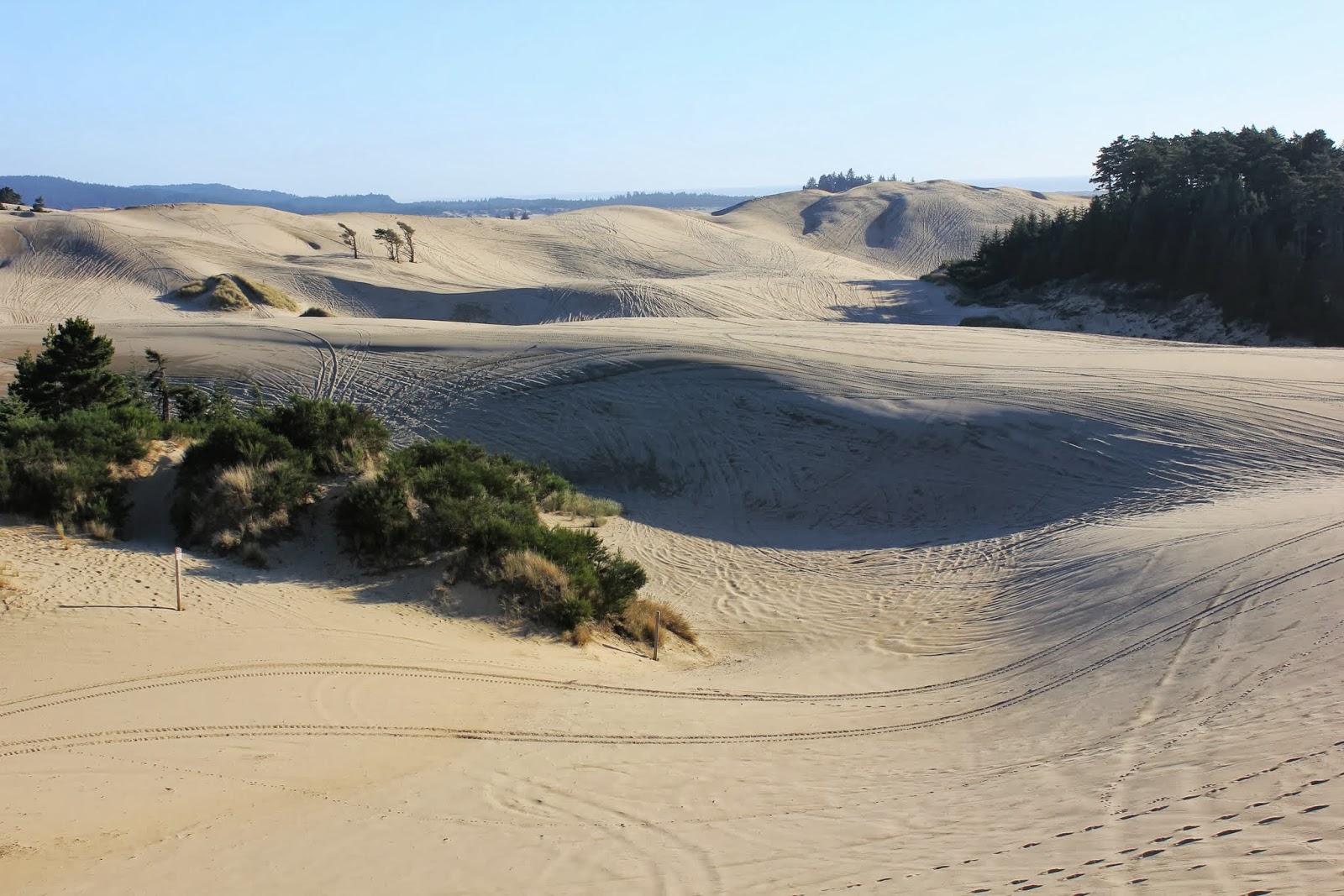
Next, we traveled to Honeyman State Park, south of Florence, which is part of the Oregon Dunes National Recreation Area.  Miles of beachfront offer ATV and OHV drivers the opportunity to play in the sand.  Alan linked up with Sand Dunes Frontier guided tours and experienced a high-speed roller-coaster thrill.  Dunes reaching as much as 500 feet are found along the coast.  Since I was left out on the dune buggy ride, that afternoon we walked along the crest of the tallest dune we could find.

The eastern portion of the park offers Lake Woahink for boating and fishing.  Kayaking the following morning with our fishing gears, we tried to snag some trout or large-mouth bass but never even got a hit.  Old Town Florence presented a classic car event that coordinated with our visit.  126 beautifully customized vehicles lined the streets, mixed with some 50’s era music playing in the background.  An open-air market offered fresh produce and a variety of arts and craft near the town docks, and some yummy clam chowder made it a great visit.
Heceta Head Lighthouse

Dunes near Honeyman SP

Florence waterfront


Devil's Churn


Pacific City Beach

Harbor seal near Yaquina Head Lighthouse

Yaquina Head Lighthouse

Heading up the dune

Alan in the dunes buggy

Along Hwy. 101

Bridge designed by Conde McCullough
 
Overview near Heceta Head Lighthouse

Nehalem, Oregon

Port of Garibaldi and cloud "mountains"
Having planned a rendezvous with our friends, Rich, Gloria and their daughter, Lynda, in Nehalem, we moved quickly toward the coast.  Anticipating the opportunity to go out into the Pacific to harvest some Dungeness Crab was a highlight we were both looking forward to.  Arriving at their rental getaway, our first priority was to obtain the crabbing license.

Regulations are fairly straightforward; the shellfish license allows each crabber to
Captain Bill
retain 12 male crabs that are 5 ¾ inches across the body.  Another friend, Bill, was our captain for the day.  Supplying the boat, the traps, the bait and years of know-how, we met with him the following morning to make the trip to the Port of Garibaldi at Tillamook Bay, the largest bay in Oregon.  The launching ramp was bustling with activity.  Bill, flustered by too many helpers, wound up pulling away from the ramp with the boat still on the trailer.  As we stood around with our mouths open, he realized his mistake and returned to launch the boat.

Mother Nature supplied a perfect day, which is not necessarily the norm in
The Port
Oregon.  Rain falls an average of 150-200 days per year along the coast.  So a sunny weekend brings out crowds to take advantage of the nice weather.  GPS coordinates pinpointed the drop points for the traps based on Bill’s knowledge of the waters.  Alan tossed the traps in, as directed, and then we moved on to the Three Arch Rocks National Wildlife Refuge. 

Designated as a Wildlife Refuge by President Roosevelt in 1907, the islands are home to tufted puffins and common murres in the spring, but none were visible during our visit.  Creation of the NWR,
Three Arch Rocks NWR
came as a result of the influence of photographers William Finley and Herman Bohlman, who had witnessed the senseless slaughter of seabirds by
cruise boat passengers in the early 1900s.  Roosevelt established the first NWR, Pelican Island, in 1903 in response to seabirds being killed for plumes.  (This NWR is right in our "backyard" back home in Florida)

An unfortunate bout with seasickness meant I needed to return to port and Gloria
Alan pulling in a trap
stayed behind with me.  But the rest of the crew resumed the outing.  By the end of the day, after baiting the traps twice, they had harvested 28 of the beauties.  Alan hauled in the nets; and Lynda sorted through, ejected the illegal catch and stored the legal crabs.  In our opinion, there is no shellfish superior to the Dungeness, so we enjoyed our dinner immensely. 

Cape Mear Lighthouse
Another sunny day provided us with a chance to explore the nearby, Nehalem Falls Campground.  While kayaking, fishing, and tubing are among the activities available below the falls, we opted for merely enjoying the beauty of the park. 

Next, we traveled to Cape Mears lighthouse.  It’s the shortest lighthouse on the Oregon coast at 38 feet.  Free tours of the lighthouse are offered on a regular basis, and since the structure is so small, the workout to get to the top is minimal.  Overviews from the lighthouse and the surrounding lands are dramatic and include the Three Rock Arches NWR.
Before departing Nehalem, we arranged a final outing to collect California mussels from the rocks on the beach.  Arriving at low tide, so the mussels would be easy to grab without taking a dip in the chilly waters, we found a few places appropriate for gathering the shellfish.  The rocks were home to a diversity of sea life, in addition to our next special dinner.

We are now moving very slowly south along Hwy. 101; enjoying the beauty of the Oregon coast.


View from Cape Mear
Reflection in the tide pool

Dinner!!!
Lynda, Gloria, me and Rich taste testing the catch
Starfish and Green Anemone


Craters of the Moon and the Oregon Trail


Sunset at the Craters
In determining our route west, we noticed Craters of the Moon National Monument in Idaho.  Intrigued by the name of the park, we decided to divert our trip a little and make the Craters our next stop.  Beginning 15,000 years ago, and as recently as 2000 years ago, the 52-miles long fissure called the Great Rift erupted with molten lava.  The seven-mile loop road within the park gives visitors access to a number of short trails that lead out to various lava formations created by the eruptions.  For the more adventurous, a special permit can be obtained to explore the lava tube caves. 

Plants growing in the volcanic cinders endure the heat of up to 150
Dwarf Buckwheat in the cinder gardens
degrees in the black rock in the summer and below-freezing temperatures in the winter, so only the most resilient plants can survive the adversity.  The bizarre, and seemingly barren, environment does support a limited variety of small animals, birds, wildflowers and hardy limber pines.

Replicas of wagons used on the Trail
Moving into eastern Oregon, we targeted the Oregon Trail Interpretive Center outside of Baker City.  Fascinated by the pioneer spirit that drove hundreds of thousands of individuals and families out west, we wanted to learn a little more about the trek they made.

 An estimated 300 to 500 thousand made the trip from Missouri to Oregon between 1840 and 1869.  Poor economic conditions, stories of verdant valleys, rich soil and political issues, including the idea of Manifest Destiny, all factored into the decision to go west.  The 2000-mile trip was fraught with dangers; roughly 1 in 10 of the travelers died on the trail.

The Interpretive Center provides a presentation by a “fur trapper”, a
Oregon Trail still visible, with the landscape little changed
film and numerous historical displays.  However, the most interesting part of the center is the use of various scenes constructed, in conjunction with the use of short films, and quotes from books or journals written about or on the trip, to create a mini Oregon Trail experience as you walk through the display.  A portion of the old trail runs near the Center and wagon ruts are still visible 150 years later!


Moving northwesterly, we traveled to the Deschutes River State Recreation Area spending a night along the riverfront. Driving along the Colombia River through the Mt. Hood Natl. Forest, we took time to explore some roadways that provided a view of Mt. Hood for us as it played peek-a-boo with the clouds.
A unique campground

Lava as far as the eye can see

Along the Deschutes River-near one campsite

Stellar Jay at the campsite


Mount Hood