Pages

Showing posts with label Minnesota. Show all posts

Minnesota. Part 4

Temperance River rushing out to Lake Superior
By the shore of Gitche Gumee

By the shining Big-Sea Water

The Song of Hiawatha, penned by HW Longfellow in 1855, is an epic poem about an Ojibwe warrior and his love for a Dakota woman.  This fictional love story takes place along the southern shores of Lake Superior (or the shore of Gitche-Gumee).  I would never attempt to compete with Longfellow’s description of the lands, the wildlife, and the lake.  But, the beauty of the area is what drew us back to the North Shore roughly 10 years after our last visit.  


The rugged terrain at Temperance River State Park first started to form over a billion years ago.  Hiking a portion of the Gitchee-Gumee Trail, we traveled along the River Gorge from the waterfront to the Upper Falls.  Designated trout streams are located within the park, but after talking with an avid, young fisherman we decided not to try.  Even with his local knowledge, he caught one trout after a full days’ effort. 


High Falls at Grand Portage
Due to the lack of available campsites at several of the North Shore state parks, we moved to 
Chippewa Indian reservation lands at Grand Portage.  We lucked into sunny skies, which had been evasive, and a site overlooking Lake Superior.   

The nearby Grand Portage State Park is home to the tallest waterfall in Minnesota.  High Falls is 120-feet, though the falls are actually shared with Canada along this international border.  Along the trail to the falls, we learned the history behind the areas’ name.  As a major fur-trading route, a nine-mile trail was created which bypassed the waterfalls and rapids on the last 20 miles of the Pigeon River before it flows into Lake Superior.  Since we have never portaged more than a few hundred feet, and with the use of a kayak dolly, their feat over these craggy lands seems impossible.

Part of The Cascades

Driving south, we found a campsite at Cascade State Park for a few nights.  Though we played peekaboo with clouds and rain, we were able to explore a number of trails.  Bears had been spotted in the park, so when venturing away from other hikers we would occasionally burst into song.  Supposedly, bears will generally try to avoid people and we wanted them to know we were there.   Named after the Cascade River, the highlights of the park are The Cascades, a series of five small waterfalls, and Cascade Falls.

High Falls at Tettagouche State Park
Tettegouche State Park provided additional trails.  High Falls along the Baptism River can be seen on the approach surrounded by high cliffs and from below after crossing the metal Swinging Bridge.  Though most of the trail was easy to moderate, the final quarter-mile upped to a moderately difficult even with or perhaps because of the steep stairs built on the approach to the falls.  This was our final waterfall for Minnesota.  We are now departing the state and starting our slow trip back home. 


Overlook at Grand Portage Campsite
Swinging Bridge over top of High Falls at Grand Portage


Upper Falls at Temperance River

Along the Temperance River Trail

Overlook at our Grand Portage campsite

Hidden Falls at Temperance River

Susie Island Overlook 

Bridge over Temperance River Gorge

Cascade Falls

Along the Temperance River Trail

Minnesota. Part 3

Boardwalk at Scenic Park
After our quick change of itinerary, due to the NE Minnesota and Canadian wildfires, we arrived for a few days at Scenic State Park. Walking along the wooden boardwalk perched along the edge of Coon Lake, we heard the eerie, haunting call of the common loon. A couple of black dots at the far side of the lake seemed to be the source. 

Utilizing our kayak dolly, we transported our kayaks from our campsite to the nearby boat launch. Paddling out into the lake with a camera and fishing gear, we were seeking the elusive loons and the difficult-to-catch walleye. Though the loons, or what we thought were loons, always stayed a few hundred yards away, we did succeed in catching dinner. We didn't catch the walleye, we were hoping for, but a couple of small-mouthed bass. Staying out on the water for several hours, we came upon a pair of tundra swan swimming along the shore. While trying to snap a shot, a boat rounded the corner of our secluded bay making the beautiful birds take flight. It was a special experience for Alan as they flew a few feet over his head. 

Exploring the park by bike, we discovered the historic lodge. This log structure is a classic
Tundra Swan
example of the rustic-style work of the Depression-era Civilian Conservation Corp (CCC). The building was closed during our visit, as many visitor centers have been during our travels this summer. (I’m assuming due to Covid-19). But also, this structure was surrounded by multiple sprinklers and fire hoses, in anticipation, perhaps, of fires that might start near or move to this park. 

A few trails are scattered throughout the park.  
One morning, we explored the Chase Point Trail nestled between the Coon and Sandwick Lakes. Threats of rain and distant thunder cut our walk short and we arrived back at camp a few moments before the skies opened. Wildlife sightings for the park included red-tailed squirrels, chipmunks, and marmots. Though signs warned of bears in the area, we didn’t see or hear of any during our visit. They were definitely not part of the wildlife we wanted to meet on our hike.

On our final day in the park, we spotted 2 loons, as well as a small flock of tundra swans, at the
opposite side of Coon Lake. This time we launched the kayaks leaving our fishing gear behind. Paddling silently across the lake, we were able to approach the adult and juvenile loon and snap a few shots. The parent (male and female loons look the same) approached the younger loon with breakfast as we looked on. Meanwhile, the swans, startled by a canoe, took flight. The outing had been an awesome success. 

Falls along the St. Louis River

Continuing to move south, we headed to one of the most popular parks in Minnesota, the Jay Cooke State Park near Duluth. Its ”swinging bridge”, which crosses the St. Louis River, was built by the CCC.  Despite the name, the bridge does not swing, but it does provide gorgeous views of the falls upriver and dramatic and unique rock formations along the riverbed. Hiking along the Silver Creek Trail and dropping down to the River Trail spur, we were along the water for most of the walk as we passed through a forest of birch, basswood, and spruce. The next day, we took the shorter CCC trail which offers a level, grassy walk along the river. 

As rains, high humidity, and cool temperatures (40s and 50s overnight) helped the hundreds of firefighters, loggers, and volunteers fight the fires in the state, we were able to pivot back along the North Shore Drive. While the Boundary Water Area remained closed, and will not be a part of this trip, the air quality index for the coastal areas was excellent, so we headed north.

View along the River Trail
The "Swinging Bridge"


Historic CCC lodge

Five tundra swan on takeoff

Waterfalls along the St. Louis River

Tundra Swan

Reflections at Coon Lake

Minnesota. Part 2

Carnivorous pitcher plant
Driving northwest, we were headed to the Lake of the Woods area.  Stopping in Big Bog State Recreation Area for a couple of nights, we were greeted by a sorely needed downpour.  Though not nearly enough to dent the severe drought conditions, we did experience about an inch of rain. 

Big Bog is divided into two parts.  We were camped in the smaller Southern Unit near the slow-moving, muddy Tamarac River.  The river flows into the Upper Red Lake and is known for it’s known for boating and fishing, but we really didn’t think we’d want to eat any fish coming out of this water.  The critical drought conditions surely accounted for the river’s current poor condition.


The Northern Unit of the Park, located 7 miles north of the campground, includes Lake Ludlow

Along the boardwalk
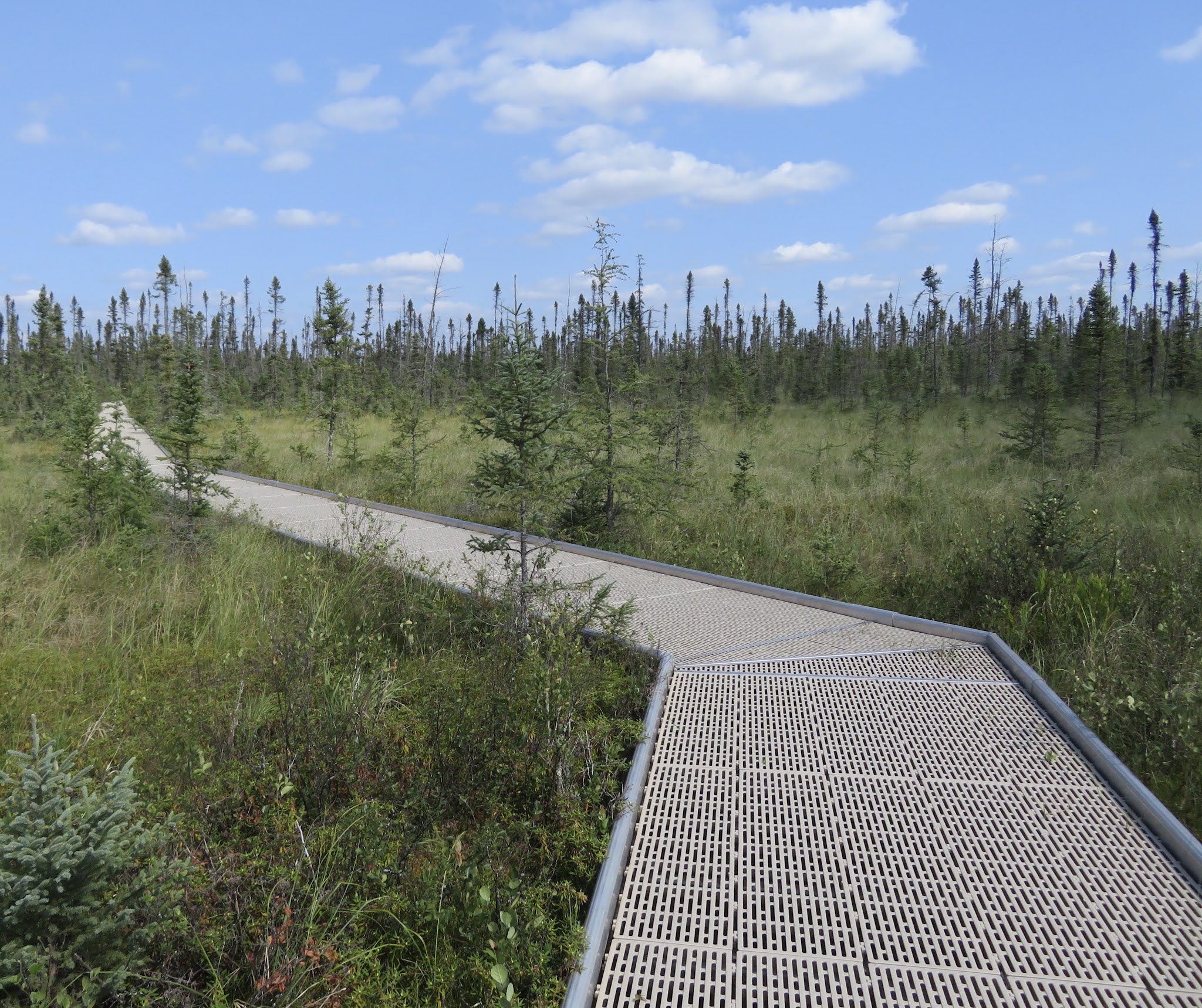
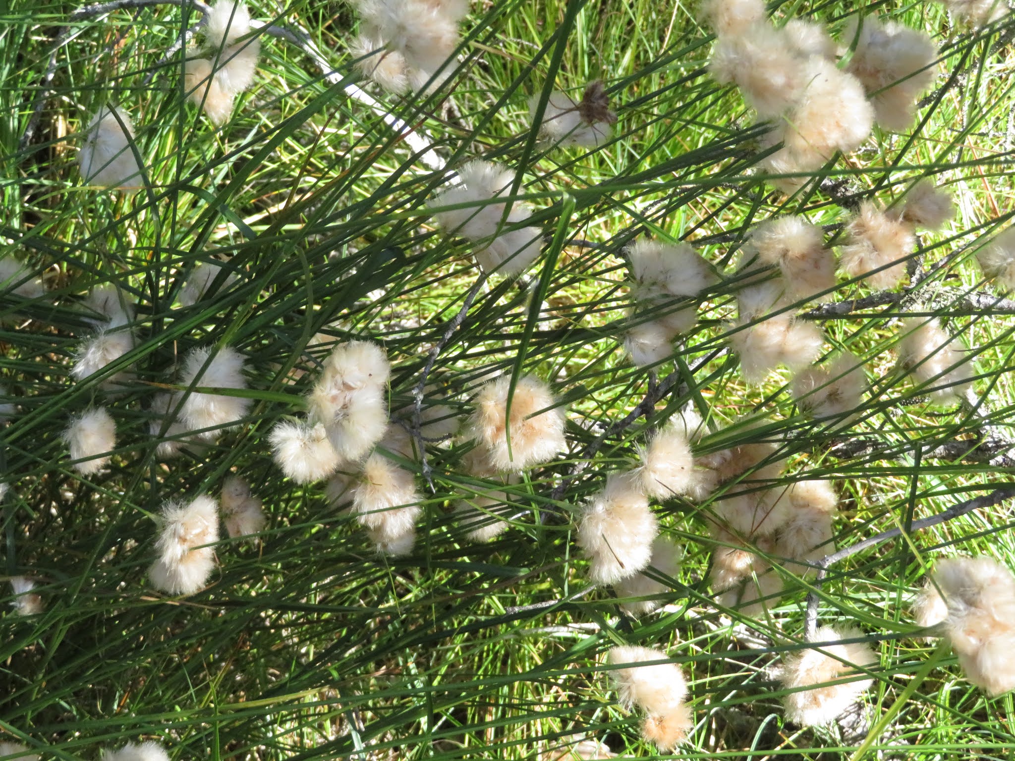
and a one-mile boardwalk over a tiny portion of the 500-square-mile peat bog.  The plastic grating that forms the boardwalk allows sunlight to reach the plants under the walk.  Numerous orchid species flourish in the bog in the early summer, but by August they have disappeared.  We did, however, see hundreds of the insect-consuming pitcher plants.  Bacteria and plant enzymes digest the bugs that become trapped in the plants.  In the late 1800s, farmers tried to tame the bog by creating canals through the peatlands.  But, the bog is an acidic and nutrient-poor wetland and attempts at farming were a dismal failure. 


Continuing to head northwesterly, we settled for a couple of nights at the town of Roseau’s campground.  On our arrival, and on subsequent outings, we took advantage of multiple bike trails around town.  One trail led us through a freshly harvested hayfield.  


Sno-cat #2
This small town of 2700 is home to Polaris Industries.  The company produces snowmobiles, all-terrain vehicles, motorcycles, and military vehicles.  They are said to employ 1500 residents, so this is a true company town.  Though tours of the factory are offered daily, we opted instead for a visit to the Polaris Experience Center.  The Center tells the story of the company that's been an integral part of this town since its inception in 1956.  From the second snowmobile ever made (the first was destroyed in a fire), to historic photos, and product displays, this tour through the company's history provides an intimate overview of the company’s founders and their challenges.  The woman showing us through the exhibit had first started working for the company in 1965 and still maintained her excitement for the company and its products. 


Driving east to Baudette, the “Walleye Capital of the World”, we secured a campsite in the

31' northern pike
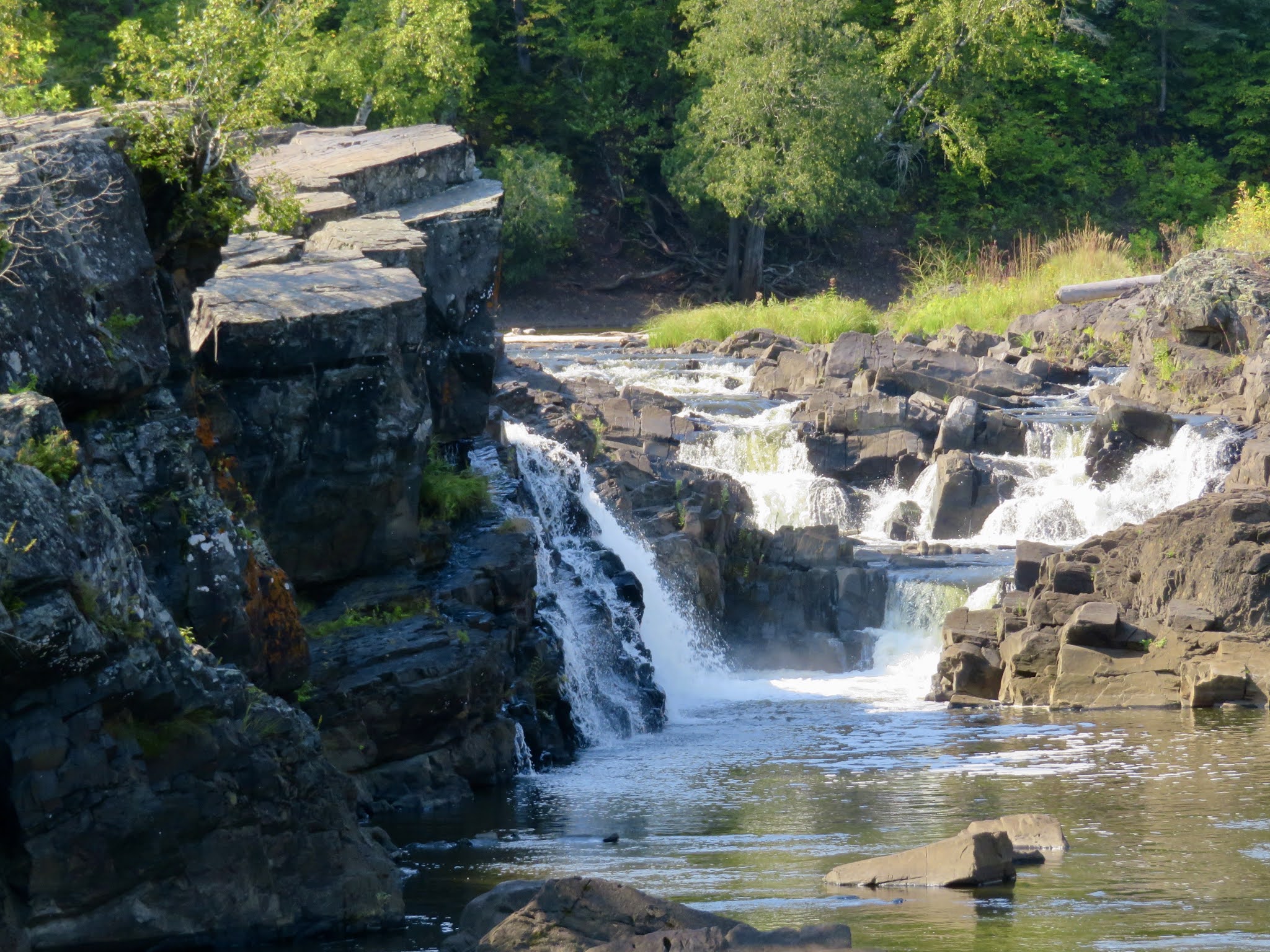
 Timber Mill Community Park.  The USA/Canadian Border was located along the Rainy River that ran fifty yards behind our site.  We had this lovely little park to ourselves.  A dock along the river provided the opportunity to try for walleye.  I had given up on fishing for the day, but within a few minutes of my departure Alan reeled in a 31” northern pike.  Along this river, that meant the fish fell within the slot that required his return to the water.  But, not long after returning the pike, he caught a 16” small-mouthed bass.  So our dinner menu was planned.    


Biking into town, we visited the Bay Front Park. This is the home of Willie Walleye, the 40-foot, 2.5-ton “ambassador” for Lake of the Woods.  Willie has overlooked Baudette Bay since 1959.


Rainy River at Franz Javne SP
Traveling east the following day, we stopped for a night at Franz Javne State Park.  At 118 acres, it is Minnesota’s smallest state park.  Walleye continued to evade us but we caught a half dozen or so small-mouthed bass but released them all.  Once again, we had the whole park to ourselves.  This time though, our campsite provided a view of the Rainy River.  


Smoke from multiple fires, we had been monitoring, in northeastern Minnesota, Manitoba, and Ontario began converging on the area.  Though our original plan was to travel further east into the Boundary Water Canoe Area Wilderness (BWCAW), we segued to the south.  The USDA Forest Service had closed access to and camps within the BWCAW, and the only road between the BWACW gateway town of Ely and North Shore Drive, our next intended destination, was closed as fires crossed the highway.  Our next destination, Scenic State Park. 

Pitcher Plant flower


With Willie Walleye


Minnesota Part 1

Along the bike trail in St. Croix SP
Be careful what you wish for…

After experiencing the daily, heavy rains in Wisconsin, we were surprised to find the opposite situation on our arrival in neighboring Minnesota.  This adjacent state was experiencing an extreme drought, and there was a statewide ban on not only campfires but charcoal grill fires as well.  At the time of our arrival, there were almost 100 wildfires burning in the state.  Luckily, most of them were smaller, but the tinderbox conditions were ripe for dangerous expansion.  Staying at the state’s largest park, St. Croix, for a couple of nights, we were situated in the central east coast region.  


St. Croix River
Initially, this park was developed by the Civilian Conservation Corp (CCC) as a recreational area in the early 1930s.  Extensive paved bike trails meandered through the park offering riverfront views or overlooks of wildflowers, grasses, pine, oak, and birch.  Though our campsite was located fairly close to the St. Croix River, kayaking upstream was something we decided against and the only service for down water pickup was closed.  Biking several times during our stay, we were able to cover a fairly large area, but only a drop in the bucket of the 127 miles of varied trails offered.


Moose Lake State Park was full but we found a site at the nearby Moose Lake City Park overlooking the lake.  On our arrival, brisk winds kept us off the water, but the following morning we headed out with fishing gear in hand.  Shortly after our departure from the beach, the winds began to build.  Even in a hidden cove, the current was strong and the fish were not cooperating.  With winds increasing to15-20 mph and white caps forming, the kayaking became more challenging.  Working back across the lake, we had water breaking over the bow of the kayaks but arrived safely back to the shore.


Morning light over Lake Shumway
At Savanna Portage State Park, we found a rustic site, no electricity or water, so we roughed it for a few days.  Of course, with the travel trailer, we aren’t really roughing it.  We just lose the niceties like AC.  Though there are 4 lakes located within the park, we were within a thousand feet of Lake Shumway, so that was our lake of choice.  On our first outing, I caught one largemouth bass and lost the proverbial “big one” that broke the line and got away.  On our second outing, Alan hit a bass honey hole and reeled in 4, and lost 2 within a few minutes.  I pulled in the largest bass for the day at around 3 pounds.  A lovely trail wraps around Shumway and offers a bog trail offshoot that provides walkways over the peatlands.  Though we considered the presence of bears on our walk, we hadn’t seen signs within the park warning of their presence and assumed since they did not offer bear-proof garbage cans that there must be no bears in the area.  Thankfully, we did not see one during our walk, but the following morning one of our neighbors told us of his encounter with a black bear the previous evening as he made a middle of the night visit to the restrooms.


Heading next into Grand Rapids, we needed to restock groceries and books, and get Alan’s

Mural in Grand Rapids
bike’s flat tire fixed.  Securing a campsite at a private RV park, we had a spot that overlooked a small lake.  We were able to catch up on emails and communicating with friends and family.  As we travel, we are frequently in areas where we have no ability to communicate with the outside world.  With no internet or phone service in many locations, it has been difficult to plan and secure reservations for our upcoming travels. 


Alan on the Paul Bunyan Trail
Moving to Lake Bemidji State Park for 3 nights, we took advantage of the park’s bike trails.  A 6-mile portion of the Paul Bunyan State Trail (112 miles total), runs through the park. Located 5 miles north of the town of Bemidji, we visited this town a couple of times.  Because Lake Bemidji is the northernmost lake feeding the Mississippi River, the town is nicknamed “The First City of the Mississippi”.   Considered the birthplace of Paul Bunyan, an 18-foot statue of the legendary figure, along with Babe the Blue Ox, is located in the center of town near the Visitor Center and near the shores of Lake Bemidji.  The sculptures have graced the waterfront since 1937 when the work was commissioned as a tourist attraction.  It is said to be one of the most photographed sites in the U.S.  In addition to Paul’s statue, over 25 murals and sculptures are featured throughout the downtown business area.


Alan's walleye!
Before departing the area, we embarked on a guided night fishing outing.  Walleye was the prize being sought. Meeting up with our guide, Josh, at Cass Lake, we headed out, in time to catch a beautiful sunset over the lake.  Fishing started strong with each of us catching a northern pike soon after leaving the dock, but both were returned to the water.  With Josh’s sophisticated fish-finding equipment, we could see the walleye we sought, but we were not catching them.  Hours later, Alan pulled in a 23” walleye.


Now, we will continue moving northwest. 

Sunset on Cass Lake

Alan with Paul and Babe the Blue Ox

Beach at Lake Bemidji at the State Park
Sculpture by Wanda Odegard near Lake Bemidji 


Sundew along the bog trail at Lake Shumway

Pileated woodpecker along the Paul Bunyan Trail

Black squirrel at St. Croix SP

Wisconsin Festival and Minnesota Loons

Matt Wahl providing morning entertainment at the Festival

Moving west toward Minnesota, we stopped overnight in Cable, WI for their Fall Festival.  Once Alan saw the sign for the Pumpkin Pecan Pancake Breakfast, I knew we would be finding a nearby campground.  This tiny town (pop. 850) knows how to put on a party.  Starting on Friday night with a pig and corn roast and lots of music, the evening finished off with an opportunity to purchase desserts submitted by local bakers for the Dessert Contest.  Saturday morning brought vintage cars lining the town street, live music performances, a farmers market, chainsaw wood sculpting presentations, dozens of craft and food vendors, and a community fund raising pancake breakfast.  Quite an affair, it was a wonderful slice of mid-western Americana.

View of North Shore from Split Rock
We had not originally planned on going to Minnesota but a couple we met in Wisconsin told us how much they enjoyed visiting the North Shore along Lake Superior.  Doing a little research online, we found eight state parks along or near Highway 61 on the 150-mile route.  How could we pass that up?  Securing a campsite in Superior, WI, we decided to leave the RV behind for a few days as we explored the North Shore.  We decided to bypass the heavily industrialized Duluth waterfront area. The harbor transports products such as coal, iron ore and grains, obviously important to this entire region, but not on our agenda.

Split Rock Lighthouse
Lighthouses on this massive lake were essential.  Split Rock Lighthouse State Park houses a lighthouse completed in 1910. For almost 60 years, it provided a light flashing out for more than 20 miles onto the Lake’s waters.  Pictures of the lighthouse from the cliffs below can help you imagine the extreme hardship of trying to complete this project in a time when no roads existed in the area.

Cascade Rivers State Park provides a trail immediately off the highway, for exploring the lovely falls.  Alternate trails lead up into the mountain and provide an overview of Lake Superior from a different perspective.  The massive lake looks like an ocean and on the day we visited, it was producing surfable waves.

Temperance River State Park provided trails along the highway and easy access to the deeply etched gorges and waterfall at the edge of Lake Superior. 

Tettegouche State Park was filled beyond capacity.  This park is the site of the tallest fall in the state at 60 feet, but surprisingly, to us, on this late September day, the parking lot and the trails were jammed with visitors and we decided to forego the visit until another day.  Unfortunately that day did not occur because when passing the park on our way back to Superior, the weather was cold, rainy, and cloudy.   Not exactly the type of scenario we would prefer for hiking.  Even though I might have rallied for the walk, Alan, at this point, had seen more waterfalls than he cared to see in a lifetime and we drove on. 

Kayaking on Leo Lake
Grand Marias was the end of our drive on the North Shore.  We decided to travel inland on the Gunflint Trail.  Hoping to do some kayaking or fishing, we explored the numerous lakes and rivers running near the Trail.   Finally, we chose Leo Lake.  On this windy afternoon, this smaller lake was sheltered by stands of golden birch.  Once we ferreted out the landing area, which was hidden behind growth along the road, we shifted the kayaks from our rooftop of the Honda to the water and loaded up our fishing gear.   Paddling out onto the lake we were soon rewarded with the haunting call of the loon.  The pair that claimed ownership of this lake (typically only one pair of loon will be on a lake) would not let us get close enough for photos but provided the extra sensory experience that made this lake special.  Once again the fish failed to cooperate, but such an ideal day on the water was not spoiled by our failure to catch fish. 

Now it was time to head south and meander toward a totally different type of location, Chicago.
Autumn coming to Wisconsin
Cable, WI cafe

Two Harbor Lighthouse